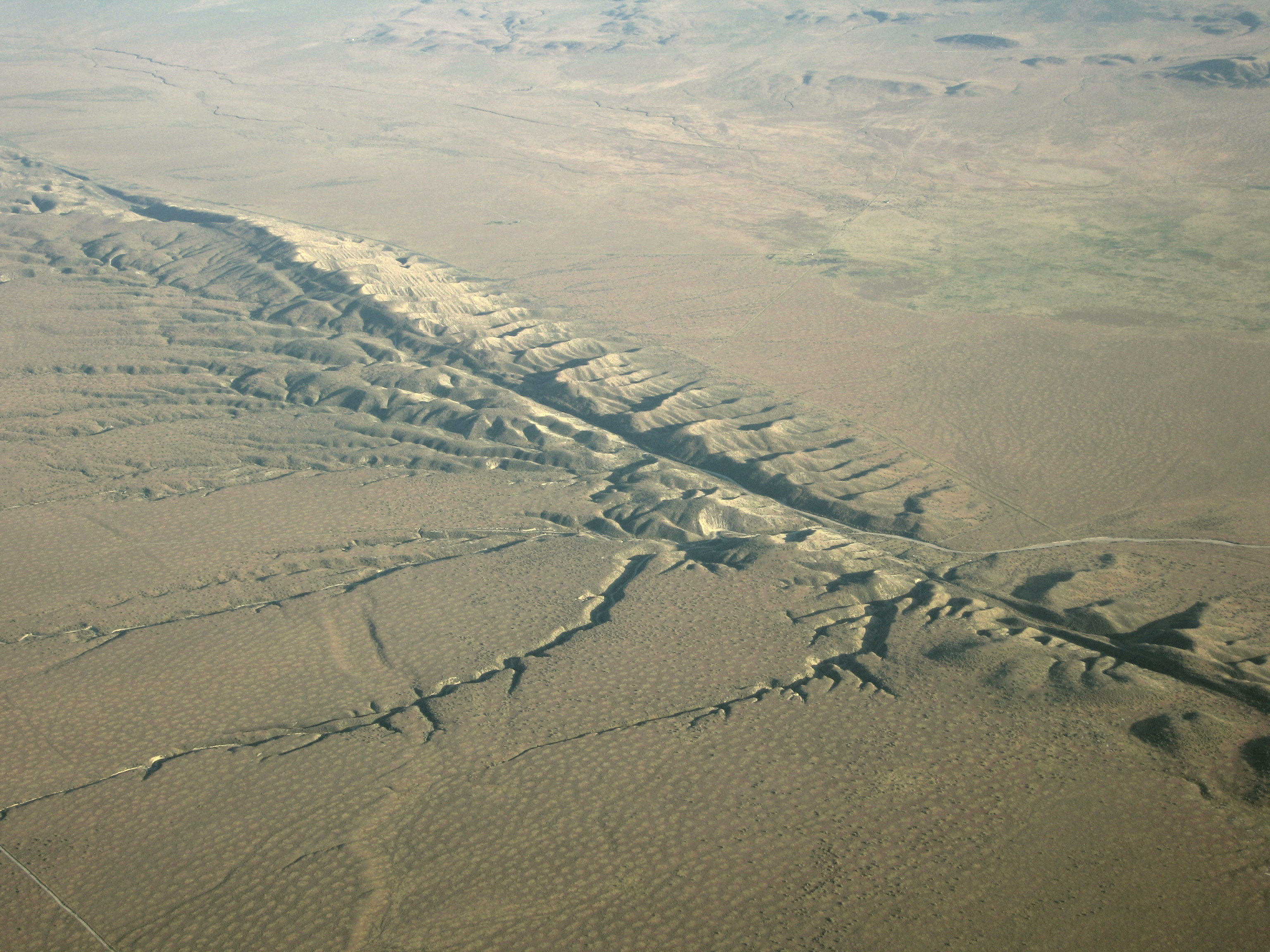
The San Andreas fault zone, which is about 1,300 km long and at some points is 10 kilometers wide, slices through two thirds of the length of California. Along the Fault Line, the Pacific Plate has been grinding horizontally past the North American Plate for 10 million years, at an average rate of about 5 cm/yr. Land on the west side of the fault zone (on the Pacific Plate) is moving in a northwesterly
direction relative to the land on the east side of the fault zone (on the North American Plate).
- The San Andreas Fault is a transform fault (a transform fault, or boundary, is a fault where the movement is mostly horizontal, and are formed when two plates slide past each other)
-It is the tectonic boundary between the Pacific Plate and the North American Plate
-All land west of the fault on the Pacific Plate is moving slowly to the northwest while all land east of the fault is moving southwest
-The westwards motion of the North American Plate creates compressional force, and that uplifts the Coast Ranges
-It is predicted that over 200 millions years the land west of the San Andreas Fault will slide past San Francisco! (This includes Los Angeles)
-4 major earthquakes have struck since 1857-2004, and the next is predicted as far away as 300 years, or one could strike tomorrow!
http://www.sanandreasfault.org/4020_A.jpg

http://geology.com/articles/images/san-andreas-fault-map.jpg

No comments:
Post a Comment